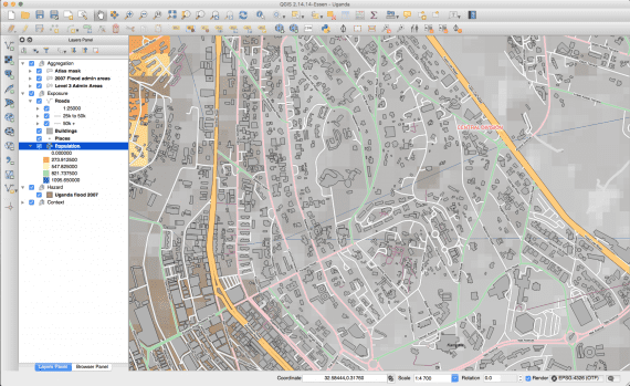
QGIS is a professional GIS application and developer platform. QGIS is built on top of and proud to be itself Free and Open Source Software.
QGIS Desktop: Powerful desktop GIS software to create, edit, visualise, analyse and publish geospatial information.
QGIS Server & Web Client: Publish your QGIS projects and layers as OGC compatible WMS and WFS services.
QGIS runs on Linux, Unix, Mac OS and Windows and supports numerous vector, raster, and database formats and functionalities.
Key Features
QGIS provides a continuously growing number of capabilities provided by core functions and plugins.
You can visualize, manage, edit, analyse data, and design maps.
Interoperability: support for numerous file formats and databases as well as web services.
Customizability: freedom to tailor the application to your needs, from custom data input forms to personalized user interfaces and workflows.
Extensibility: a C++ core and Python support provide the framework for everything from quick scripts to novel stand-alone applications based on the QGIS API.
QGIS Community
QGIS is developed by a team of dedicated volunteers and organisations. We strive to be a welcoming community for people of all race, creed, gender and walks of life.
QGIS users are found in various fields, including: government, education, planning, engineering, NGOs, military and research.
User Groups are regional organizations that run user meetings, provide a platform for common interestes and coordinate development, taking into account regional/national standards and requirements.
Developer meetings are a great opportunity to meet community members in person.
International
QGIS is a world-wide community. We are proud of our international team which enables us to provide an application that is translated into dozens of languages.
The number of regional user groups is constantly growing. User groups can be found on all continents. This means that both community as well as professional commercial support options are available world-wide.

